The VTS at Vardø in Northern Norway is one of the most sophisticated in the world. Some of the cutting-edge technology used in the C-Scope system at Vardø has been developed throughout Kongsberg Norcontrol IT’s involvement in the EU funded MarNIS project. MarNIS is a four year project that was started in November 2004 to further the use of advanced and future technology within E-Navigation. The technology focus of MarNIS includes:
The goal of the project, which was concluded with final demonstrations in Genoa, Italy and Lisbon, Portugal in September and October 2008, is to integrate these technologies into one operator facing system and C-Scope has been used as the platform for which to build upon.
“MarNIS has enabled Kongsberg Norcontrol IT to develop some really exciting new technologies and functions,” states Einar Lihod, Kongsberg Norcontrol IT. “We can now provide shore based radar video in an internationally standard format so that Pilots, Tugs and Allied Services can visualise the same radar video provided to VTS Operators. To the best of my knowledge this is another world first for Kongsberg Norcontrol IT.”
MarNIS Demonstrations
Kongsberg Norcontrol IT presented two different areas of development during the two final MarNIS demonstrations. In Genoa, the focus was on ‘MOS - Maritime Operational Services’, a new concept proposed by MarNIS where services like coastal Vessel Traffic Services, Search and Rescue and Pollution Prevention are combined under one roof and by using one information system. A MOS system integrates information from numerous other systems that can be located internal or external to the MOS organisation. Examples of such information are:
- Dynamical risk values per vessel, based on type of ship, cargo, age and flag of ship, weather and sea state info, traffic info, distance from shore, etc
- Satellite based or aircraft based images of oil spills
- Oil spill information from oil retention/recovery vessels using onboard radar for day and night surveillance of a detected oil spill
- Results from object drift simulations, where object may be person in water, container, vessel or oil spill
- Long Range Identification and Tracking (LRIT) and space AIS (Automatic Identification System).
The focus for the final MarNIS demonstration in Lisbon moved to Vessel Traffic Management in the port environment and one of the primary concepts demonstrated was Sharing VTS Information Using Standards. This included:
- Sharing traditionally shielded/closed VTS information with external systems and organisations such as pilots, police and customs
- Sharing AIS data from the AIS Base Stations or AIS Network that are used by the VTS
- Sharing radar video from the VTS radar stations and radar tracks from the VTS radar trackers
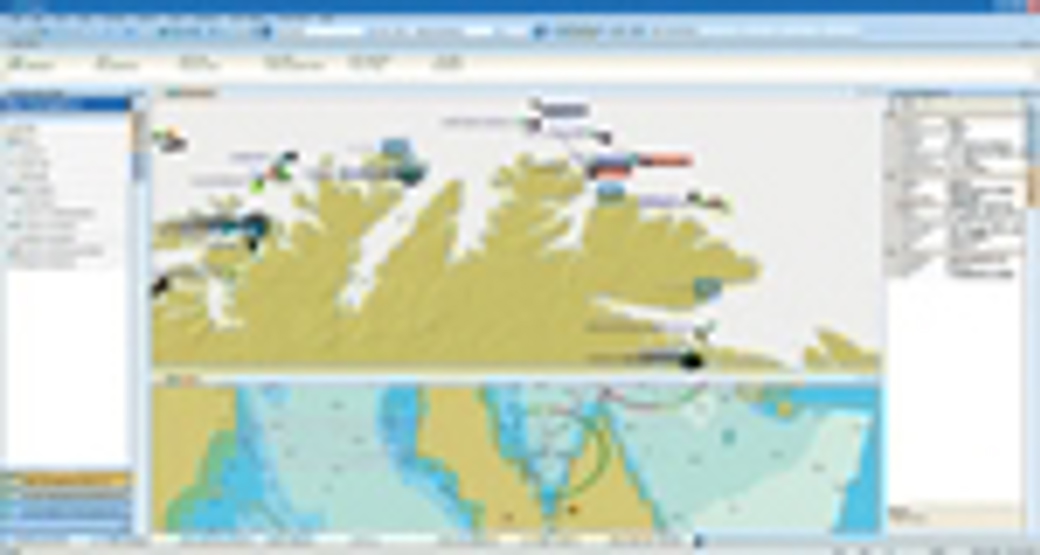
C-Scope has been designed to not only provide an accurate picture of the maritime domain using traditional sensors such as radar and AIS, MetHyd, CCTV, SCADA and RDF, but to combine this with a Geographic Information System (GIS) to ensure operators have relevant information presented to them in a timely and efficient manner.
The C-Scope Operator Client provides a coherent Traffic Image with critical information easily accessible at all times including radar video, tracks, weather, oceanographic and satellite imagery. As demonstrated in Lisbon, the system has also been designed to ensure that information from both internal and external databases can be collected, correlated and exchanged with other stakeholders such as vessels and authorities.
The Vardø VTS
The new, cutting-edge VTS at Vardø, in northern Norway is based on leading VTS developer Kongsberg Norcontrol IT’s ‘C-Scope’ and its recent expansion southwards makes it responsible for one of the largest single maritime domains in the world. It covers high latitudes where energy companies are involved in oil & gas exploration and the safety and security that C-Scope provides enables further, sympathetic development of this sensitive area.
“C-Scope is an ideal solution for Vardø, especially following the extension of our VTS Area, as it is fast and provides our operators with decision support tools to highlight vessels at potential risk, which is often a problem when dealing with such a vast sea area. Environmental protection is also a core requirement for the Vardø C-Scope VTMIS. C-Scope provides our operators with optimum situational awareness by ensuring an uncluttered and logical interface that identifies risk, enabling them to provide a safe and efficient maritime domain,” said Jarle Hauge, Engineer in Chief, Norwegian Coastal Administration.
The high risk and management of these risks in areas such as Vardø has been part of the catalyst in the development of new VTMIS functionality and it’s Kongsberg Norcontrol IT who has been spearheading this. In addition to the C-Scope Operator Client the company has invested a large amount of resources into improving the quality, clarity and definition of a VTS radar service. The result is the new C-Scope Extractor and Tracker, a sophisticated software application that enables VTS operators to clearly define small targets from clutter, which in today’s security conscious climate, is a vital tool.
“The end of the MarNIS project signals the beginning of a new era for VTS. Some of the benefits in technology development gained from MarNIS are already in use, such as at our C-Scope installation in Vardø,” says Inge Flaten, President, Kongsberg Norcontrol IT. “With Vardø as the forerunner, proving the performance of C-Scope, we are ready to implement this new functionality in other VTS installations around the world, whether they are already running C-Scope or are ready to make the change to the cutting edge of VTS.”
Although the MarNIS project only recently ended with the final demonstrations in Genoa and Lisbon, the benefits in technology development are already live in Vardø and are ready to be implemented in other key VTS installations in Europe and around the world.