The Pecém's Harbour Project
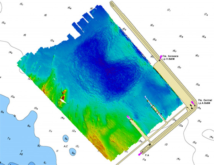
A survey of the harbour in Pecém (Ceará State) was completed at the end of 2016. It has proven to be an important project that will help to improve the efficiency and security of harbour operations not just in Pecém, but the whole of Brazil.
The project used a Kongsberg EM 2040 multibeam system installed on a small boat to survey the harbour according to Brazilian Navy requirements, which are based on international standards. Like all of Brazil's 30 harbours, Pecém had been struggling to find a way to have its area properly measured to the Navy's standards, which are considered by many to be very demanding. Ultimately, the project was a cooperation between the Brazilian Navy, the Waterway Nacional Research Institute (INPH), Pecém's harbour authority and Kongsberg Maritime.
With the assistance of a KONGSBERG Service Engineer, the entire system was installed on a single structure with Seapath 330 antennas on top, MRU 5+ in the middle and the EM 2040 transducers on the bottom. The position of these sensors was precisely measured. The structure was fixed on the side, and aligned, to compensate for the roll, pitch and heave offsets related to the boat.
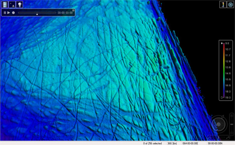
To survey the area, the boat had to run several lines using the EM 2040 to acquire data from the seabed in order to create a precise and reliable image of the area's topology. To ensure that the survey met the required standards, it was important that the data matches perfectly every time the system overlaps the swath on different lines. This is especially tricky in harbour areas, where the water's properties can change very quickly and the tide can cause the water level to vary by metres during the day. Additionally, large vessels and dockside structures can create interference for the position reference systems. To solve these issues, sound velocity profiles were measured constantly, and a tide sensor station was installed inside the port to post process the raw data from the EM 2040. The harbour administration was also very helpful in managing vessel traffic during the survey.
Another challenge faced was related to the small structure movements between the MRU and the transducers, which can cause mismatch on the data. Because of this, the survey was limited to a certain speed and sea conditions, which delayed the conclusion of this project.
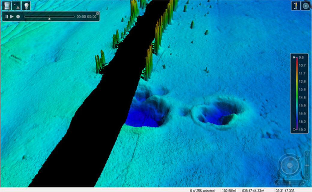
After about one month, the project was finally completed during the second week of December 2016. The area is now surveyed in detail and approved by the Brazilian Navy, bringing much more efficiency and safety to harbour operations. The project will contribute positively to vessel operations in Pecém. For instance, the survey found a huge underwater object left over from construction, which was not known about previously. The structure was a significant risk for vessel operations so it was decided to remove it immediately.
Following this project, INPH is expected to order 2 - 3 more EM 2040 systems and training in 2017. The organisation strongly believes that KONGSBERG has, by far, the best product in the market for this purpose. Underlying the main goal of this project, there is an important conclusion to be reached: It is possible to meet the Brazilian Navy's survey requirements accurately and efficiently, so there is now finally a solution for the other 30 Ports across Brazil to achieve the same outstanding results.
Facts about the project
Challenge
Pecém, as all the other 30 harbours in Brazil have been struggling to find a way to have their area properly measured inside Navy's standards, which is considered by many on this business, as very demanding.
Approach
To survey the area, the boat had to run several lines, using the EM 2040 to acquire data from the seabed, creating a precise and reliable image of the area's topology. To have this survey approved, it is very important that the data matches perfectly every time the system overlaps the swath on different lines. This is especially tricky in harbour areas, where the water's properties can change very quickly and the tide can vary meters during the day. There are also position interferences next to huge vessels alongside the harbour. To solve these issues, sound velocity profiles were measured constantly, and a tide sensor station was installed inside the Port, to post process the raw data from the EM 2040. Also, the harbor's administration was very helpful on removing vessels to help the survey.
Success
After around one month, the project was finally completed on the second week of December 2016. The area is detailed surveyed and approved by the Brazilian Navy, bringing much more efficiency and safety to the harbor's operation.