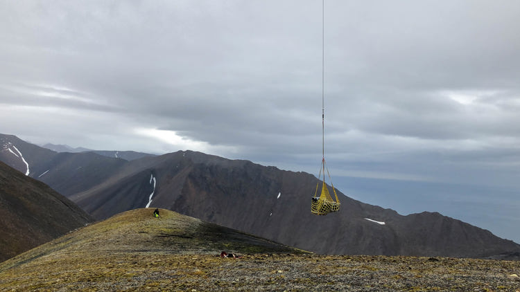
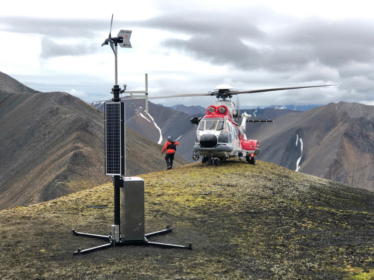
During Autumn 2019, two additional base stations powered by solar and wind energy will be installed on Walterfjellet mountain and Amsterdam Island, located off the north-western coast of Spitsbergen. When all three base stations are up and running, the Norwegian Coastal Administration, and other Norwegian authorities, will have updated information on all ocean-going vessels in the area. The base stations will receive AIS signals from vessels sailing up to 40 nautical miles off the coast in the area from Hornsund in the south to Amsterdam Island in the north. The base stations record information on the vessel’s identity, position, speed and course.
The waters around the Svalbard archipelago are monitored by the Vessel Traffic Service (VTS) centre in Vardø. In recent years, the VTS centre has registered an increase in ship traffic along the north-western coast of Spitsbergen. Especially from cruise ships, research vessels and fishing vessels.
“New AIS base stations along the north-western coast will enable us to improve ship traffic monitoring in this area. It will enable us to see the location of passenger ships and vessels with hazardous cargo at any given time. Thus, we can assist vessels more quickly or initiate damage control measures faster”, says VTS Manager Ståle Sveinungsen at the VTS centre in Vardø.
Improved maritime situational awareness
AIS is a measure in the Government’s work to strengthen maritime safety and emergency planning. The development at Svalbard is a part of the Government White Paper, Meld. St. 35 (2015-2016).
The Automatic Identification System, AIS, is an important monitoring tool in the national preparedness and emergency planning for the maritime sector. AIS provides real-time data which enable continuous maritime traffic monitoring and allow for increased efficiency in search and rescue operations. The data from the Norwegian Coastal Administration's AIS base stations are distributed to the Joint Rescue Coordination Centres, the Governor of Svalbard and the Norwegian Coast Guard.
Monitoring data from AIS satellites and land based AIS base stations located along the south-western coast of Spitsbergen, are currently being used. The AIS satellites orbit the earth and record ships each time they pass over Svalbard, while land based AIS provide updated information on the ships’ voyage.
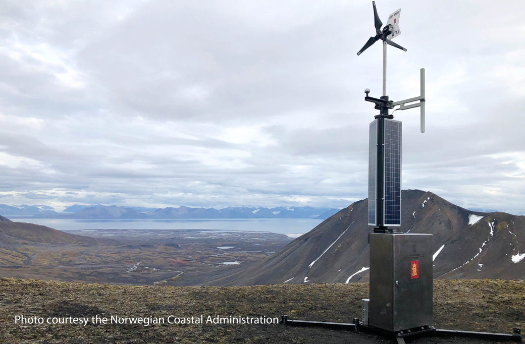
Environmentally friendly infrastructure
These will be the first AIS base stations powered by solar and wind energy in Norway. The base stations are developed by Kongsberg Maritime. They are customised for use in areas lacking in infrastructure such as power and electronic communication services, and areas where environmental preservation is important.
“The Norwegian Coastal Administration considers this to be a unique and ground-breaking project. For two years we have been testing various solutions which enable the base stations to be operable in isolated, exposed and environmentally vulnerable areas, without any kind of existing infrastructure. The new base stations will run on solar and wind energy and they will be 100 per cent emission free”, states project manager Harald Åsheim in the Norwegian Coastal Administration.
Planning for increased ship traffic
"In recent years we have seen that cruise ships visiting Svalbard have become larger and carry more passengers. In that respect, AIS is an important safety measure when it comes to monitoring the increasing ship traffic around Svalbard”, says Arve Dimmen, Head of the Department for Maritime Safety in the Norwegian Coastal Administration.
In the Norwegian Coastal Administration’s “Maritime Safety Analysis” from 2014, the development of land based AIS at Svalbard is described as a highly effective risk-reducing measure to prevent ship groundings and collisions. The development of land based AIS on Svalbard is a part of the Norwegian Coastal Administration’s long-term effort for maritime safety.
“In 2020 and 2021 we plan to deploy AIS base stations at Sørkapp (South Cape) and on the east coast of Spitsbergen, including Hinlopen. Our objective is to obtain the same overview of ship traffic in the waters around Svalbard as we have along the coast of mainland Norway”, Dimmen states.
Media contact