By Steve Wilcox, Pete Notman and Josh Mountjoy.
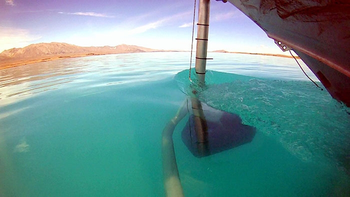
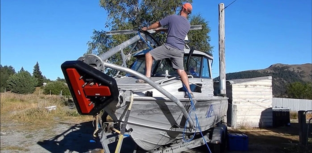
The National Institute of Water and Atmospheric Research (NIWA) recently carried out a bathymetric and seismic survey of New Zealand's Lake Tekapo. The bathymetry data was acquired with a Kongsberg 0.4 x 0.7 degree EM2040 system.Due to the relatively remote location of Lake Tekapo, the EM2040 pod was fitted to a trailerable 6.8m monohull. A pivoting bow mounted deployment system was designed which allowed the EM2040 pod to be lowered into the water when on site with a high degree of repeatability. An Applanix POSMV system was used to provide position and attitude information with the antenna mounted directly above the EM2040 pod. The acquisition hardware (EM2040 transceiver, IMU etc.) was located in the forward cabin as close to the pod and antenna as possible so as to reduce any potential lever arm issues.
When the EM2040 system was deployed, the multibeam pod was 1 meter below the lake surface and stable at speeds of up to 7 knots surveying in water depths greater than 150m.
Steve Wilcox, Principle Geology Technician had this to say: "The EM2040 has proved to be a very reliable system and it is a valuable upgrade to our high resolution shallow water survey capability".