KONGSBERG GeoSwath Plus COMPACT multibeam echosounder chosen to gather data up to the waterline with a coverage of up to 12 times the water depth in shallow water environment.
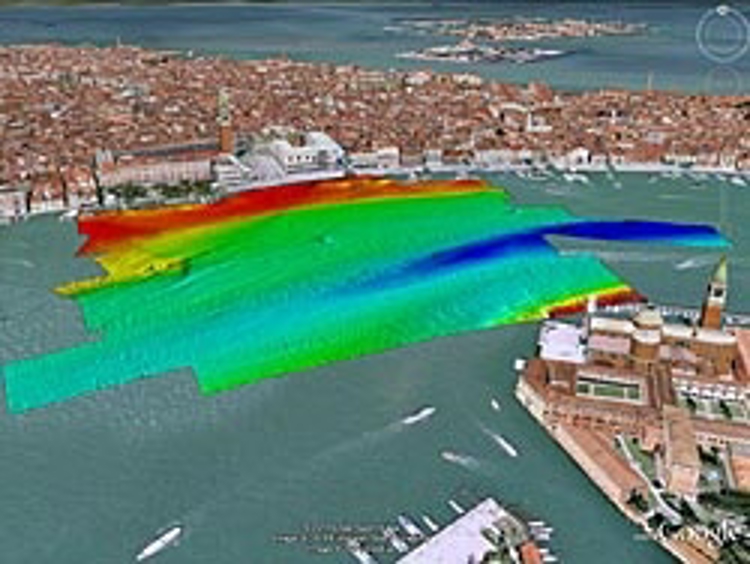
Kongsberg GeoAcoustics was recently invited by the The Venice Institute of Marine Science (ISMAR-CNR) to demonstrate their GeoSwath Plus technology by gathering high resolution bathymetry data for monitoring changes in the Venetian Lagoon.
The Venice Institute of Marine Science (ISMAR-CNR) is engaged in research and monitoring projects of the lagoon. This is the world’s best known estuarine lagoon, which does not only have historical importance for sheltering the City of Venice but is a fascinating ever changing environment with only 8% covered by land, 12% by open water and the remaining 80% by mud flats, tidal shallows and salt marshes. This geographical setting, hosting complex ecosystems, is influenced by tidal cycles entering through three sea inlets and freshwater and sediment supplied by river influx.
Monitoring of changes to the environment is becoming ever more important with changing sea levels and as the human impact increases. The MOSE flood protection project enables the closing of the sea inlets and dredging activities.
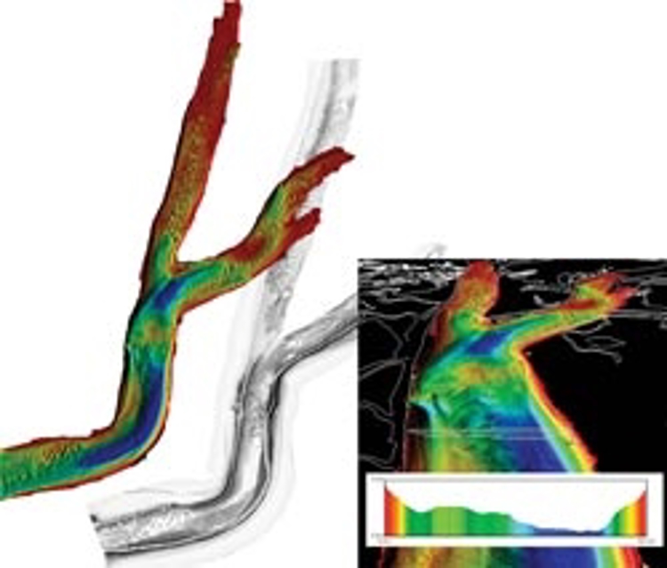
The GeoSwath Plus COMPACT effectively covers large, very shallow water areas providing highly repeatable data to allow monitoring of even the smallest changes through time. Kongsberg GeoAcoustics GeoSwath Plus Compact multibeam echosounder was chosen due to its capabilities to gather data up to the waterline with a coverage of up to 12 times the water depth in shallow water environment. Repeat surveys were carried out and showed to be consistent albeit the difficult hydrological conditions with large tidal currents and fresh water mixing, leading to high temporal and lateral sound speed variations. In addition the system offers true co-registered and geo-referenced side scan data which can be used for seabed classification and textural mapping.