The following story comes from the ship's diary of the Royal Navy ice patrol ship HMS Endurance.
From the ship's diary
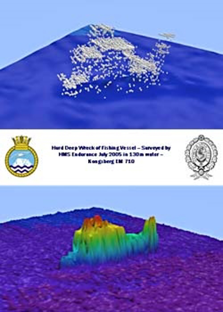
Immediately following the success of the International Festival of the Sea HMS ENDURANCE sailed to conduct trials on her recently commissioned ef designated EM710S. This is a state of the art system, at the leading edge of multi beam echo sounder technology and one of only two equipment at sea. The other is fitted in the Canadian Arctic icebreaking ship MATTHEW. Developed by the Norwegian commercial sonar specialists Kongsberg Maritime it has been especially designed to fit flush with our ice breaking hull. As can be seen from the accompanying image the results achieved are quite incredible, with this previously unlocated wreck being detected and readily identified in 130m of water.
But how does the system work?
The following attempts to explain:
A pulse of sound is radiated vertically under the hull of the ship from the transmit array. With the application of very sophisticated processing at the receive array the returning echo is divided into 200 beams. Thus a swathe of data of up to 4 times the water depth is collected. This is a quantum leap forward in our surveying capability. Previously the ship has operated a Single Beam Echo Sounder recovering 1 sounding from beneath the ship, with the data density achieved being a function of line spacing between survey lines. Now line spacing can be increased and much more data can be captured.
This then means that we can generate highly detailed 3-D images of the sea bed, all while surveying at 5 times the efficiency of previous SBES work. The wreck was detected on our first pass and with increased data contributing from four more passes at different ranges and orientations the processing software was able to construct the image of the wreck, which is believed to be a fishing vessel lying upright on the sea floor. The upper image represents each data point (the white squares), the lower image is colour banded to show depth differences. The wreck stands 8m high above a relatively flat surrounding seabed. With some interpretation it is easy to imagine an ‘A’ frame gantry at the stern of the vessel (right hand side of the images) immediately ahead of a flat working deck, a pointed bow forward (left hand side) and between a raised deckhouse and wheelhouse.
As intimated the system is complex. We have very accurate positioning systems, which can generate a position precise to less than 2m anywhere on the globe. Similarly we have a series of fibre optic gyros which measure the orientation of the ship to a precision of less than 0.05 degrees. This means that the multi beam sonar is continuously and accurately corrected for all movement of the ship, allowing the depths to be properly located on the seabed and contributing significantly to the our safe navigation in the areas we survey. We also have to precisely measure the sound velocity profile, deploying a sensitive probe which indicates how the speed of sound in water varies with depth. This is deployed from a winch with an 800m depth capability. When deployed off the coast of Florida it attracted the attention of a playful fish, possibly a shark, which left a series off teeth marks in the casing of the probe!
We will use the multi beam echo sounder extensively during our next deployment to the Antarctic. As agreed by the United Kingdom Hydrographic Office we will operate the new system in various locations to improve our knowledge of the topography beneath the waves. Our data will also contribute to the safe navigation of other vessels visiting the region.
About the HMS Endurance
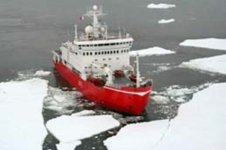
The HMS Endurance is a Royal Navy ice patrol ship with a mission to patrol and survey the Antarctic and South Atlantic, maintaining very close links with the United Kingdom Hydrographic Office and the British Antarctic Survey. She normally spends up to 7 months each year on deployment.