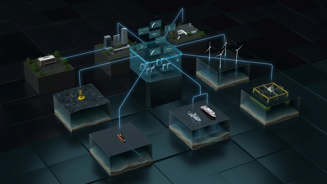
Expanding the digital toolbox to best support the Blue and the New Blue Economy
Building on an established relationship as part of the 2nd phase of the Glider project financed by ConocoPhillips, KM and Akvaplan-niva have signed a contract to further expand the Blue Insight capabilities to better serve requirements for ecosystem monitoring by industrial users of the ocean space. While the first part of the add-on focused on real time 2 and 3D visualization of ocean data in the dedicated Ocean View module, the last part of the contract has a longer time span and focuses more broadly on efficient data management to optimize Blue Insight as a more holistic tool for Akvaplan-niva to secure economic value and safe environmental operations for businesses and authorities in all water related issues.
During 2021 the work on the digital infrastructure focused on setting up the BI environment and advancing the multi-platform operation and data visualizations. The latter were realized in 2D map projections as well as 3D environments that also include and show relevant offshore assets together with external information-bearing background layers. Vehicle tracks can be displayed together with measuring data and additional features such as AIS supported positions of vessels in the vicinity, all tremendously supporting contextualization within the monitoring endeavors.
Due to the intensification of the joint efforts during the project period until 2023, the dedicated team of programmers could be enlarged. While further enhancing the visualization capabilities (i.e. the Ocean View module) remains in focus during the project, clear emphasis is put onto data management in the broadest sense, comprising the elements of data flow, sharing, quality control and analysis.
The visualization work will e.g. progress several aspects related to comprehensive and seamless 4D data and vehicle track displaying as well as cover application specific dashboards. The work on data flow will introduce an advanced data indexing and cataloging environment for improved searchability of the growing amount of data. Further, the realization of automated data pushes to selected stakeholders by using the Data Forwarder Module of BI will demonstrate efficient data sharing. Conductivity and temperature data from the glider vehicles will e.g. be shared in real-time with the Norwegian Meteorological Institute for automated consideration within physical ocean modelling (Norkyst).
For an advanced digital environment to optimize the handling of ocean data, automated data quality control and analysis is important. A central element in this context will be the realization of a customized, cloud-based processing environment with sandboxing capabilities usable with different programming languages. Data analysis will be further addressed through the implementation of an in-cloud classifying framework used for the processing of the echosounder data.
The deep domain knowledge and close collaboration of the project partners together with clear focus and dedication materializes in steadily enhancing the efficiency of complex monitoring missions in the interest of the customers and stakeholders. As part of this process Akvaplan-niva has already been using the BI environment successfully for additional environmental monitoring projects at the polar front around Svalbard and within a floating wind park, both on behalf of energy majors, as well as within international research projects (e.g. http://www.bioglider.eu/).