SIS Remote
Control the EM system from anywhere
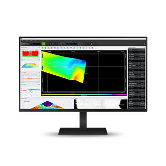
With SIS Remote you can operate the KONGSBERG EM system remotely. The SIS Remote setup is simple, requiring only licensing and network configuration, for fast or slow connections within any price range. For ship-to-shore transmission, SIS Remote can function efficiently with various carriers including 4G/5G mobile network, WiFi, satellite, or KONGSBERG's Maritime Broadband Radio, the MBR. The EM system can be controlled from a remote location on another ship, on shore or in the cloud.
System requirements
- A remote computer
- A SIS Remote license must be installed on the vessel's Seafloor Information System (SIS) software dongle
- The Mosquito message broker application must be installed and set up for the communication between the system components
- An Internet or another network connection must be provided for the two way communication between the multibeam system and the remote computer
Versatile control and monitoring
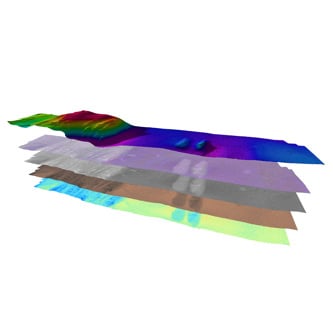
SIS Remote can handle several EM-systems at the same time, displaying combined DTMs from all connected systems in the same geographical view for a complete oversight. The full DTM from each boat will be uploaded from ship-to-shore when SIS Remote connects. SIS Remote opens in "view" mode, and the oncoming surveyor enables or requests "command" to ensure surveys are not inadvertently interrupted. SIS5 operators can easily transition into using SIS Remote with little additional training.
Remote survey planning
Create points, lines, and polygons pre-survey in the SIS Remote interface on the remote computer rather than fighting latency with a remote desktop configuration. Once the objects and plans are ready, simply transfer to the vessel to take advantage of the automated logging features. You may select to start and stop logging or increment the lines at the start and end of a planned survey line, or at a polygon border. As the vessel moves through the plan, the active line will automatically be highlighted to indicate the current track. Once a line plan is sent to the vessel, other remote operators will see the active line plan for situational awareness and watch handover discussion.
Optimized data and communication management
SIS Remote is engineered to facilitate remote operations and multi-survey setup with flexibility in data transmission rates to suit various internet connection speeds. Its configuration allows for effective quality control and steering of survey operations via updates of the terrain model - a feature beneficial even with slow satellite connections. Utilizing MBR bestows operators with the advantage of real-time of real-time, hands-on control over the surveying process, elevating operational precision and effectiveness.
Key features
- Dispersed workforce: The surveyors can be located anywhere with an internet connection
- Minimal training: Remote operators are using the same interface as is on the vessel
- You can operate and monitor multiple vessels in one application
- You can transfer the point cloud to shore for processing and visualization
- You can troubleshoot remotely with shore support able to see the current sonar settings
- Plan lines ashore and send to the vessel and other remote operators
Product range
How can we help?
If you are experiencing any issues or have technical questions regarding your equipment, please don't hesitate to reach out. Our dedicated hydrographic support team is here to assist you with any challenges you may encounter.
Related products
We offer comprehensive after-sales assistance
-
24/7 Technical support
Our Technical Support team is readily available to provide global 24/7 support and can respond to resolve any issues at any time, wherever you are located in the world.
-
Training
We can provide detailed training on the use of our products to ensure your crew is equipped with the necessary operational competence to minimise technical risk and maximise return on your asset investment.
