
Offshore Wind
Renewable energy
The offshore wind farm sector is expanding quickly, and offshore wind farms are becoming increasingly popular to meet the world’s growing need for renewable energy. KONGSBERG offers state-of-the-art technology solutions and the unrivalled expertise essential for this green power revolution.
With more than 50 years’ experience in oil and gas, KONGSBERG is a pioneer in subsea survey and monitoring. This experience underpins our disruptive technologies for pre-survey, inspection, and maintenance of offshore wind farms.
Helping surveyors and operators gather and turn ocean space data into actionable insights.

Subsea positioning and communcation
Enable accurate tracking and communication with underwater assets using acoustic positioning systems. These systems are essential for guiding AUVs, ROVs, and other subsea platforms during inspection, mapping, or installation tasks where GNSS signals cannot reach.
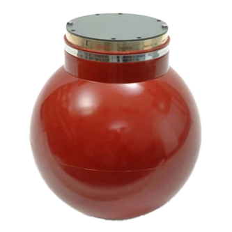
HiPAP
Acoustic positioning systems are used to position subsea objects relative to a surface vessel or to position a surface vessel relative to a seabed reference transponder. The HiPAP model range covers positioning application from shallow water to the deepest parts of the ocean.
Read more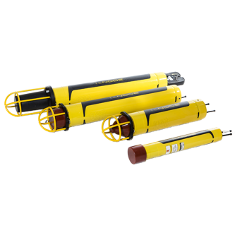
cNODE transponders
cNODE® is a series of transponders for underwater acoustic positioning and data link. They can be used and positioned by HiPAP® underwater positioning systems
Read more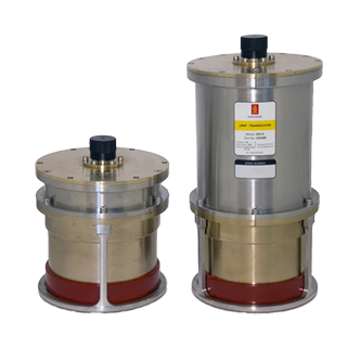
microPAP
The μPAP (micro Portable Acoustic Positioning) system is a small and compact acoustic positioning system designed for operation from a surface vessel. It can track ROVs, tow fish, divers, and other subsea objects at ranges of several thousand meters.
Read more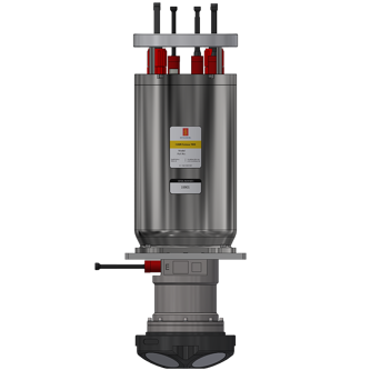
HAIN Subsea 7000
Integrated inertial navigation system for subsea vehicles. The solution can operate on an AUV, ROV, towed fish and any other subsea vehicle down to 7000 meters water depth
Read more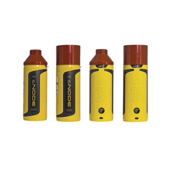
cNODE modems
A cNODE modem is a communication device used in underwater acoustic positioning systems. It facilitates data exchange between surface vessels and subsea transponders. Modems are deployed on surface vessels or buoys, providing a link to submerged equipment.
Read more


GNSS & Inertial navigation for reliable positioning
Ensure accurate and continuous navigation for vessels and offshore platforms by integrating GNSS (Global Navigation Satellite Systems) with Inertial Navigation Systems (INS) and Motion Reference Units (MRUs). This hybrid approach provides stable positioning even in environments where satellite signals are weak, obstructed, or intentionally disrupted—such as near turbines or during adverse weather conditions.
Seapath
Seapath is a navigation system that combines satellite and inertial navigation technology to achieve exceptional accuracy for surveyors mapping depths down to 10.000 meters.
Read more

Dynamic positioning during offshore operations
Maintain a vessel’s exact position and heading automatically using Dynamic Positioning (DP) systems. These systems integrate GNSS, INS, and thruster control to counteract wind, waves, and currents—ensuring stability during sensitive offshore tasks like turbine installation, cable laying, or maintenance.
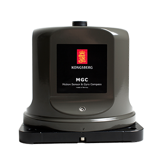
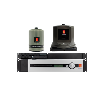
MGC
The MGC is a fully inertial navigation system (INS) capable of outputting heading, roll, pitch, heave, and position. The unit can also serve as an IMU in other systems, designed for high precision maritime applications including offshore operations and seabed mapping.
Read more
DPS series
The DPS product series is developed and suitable for all applications in need of a confident position solution when operating in safety-critical environments.
Read more


Operating in Offshore environments comes with challenges
Harsh weather and tight margins place high demands on the equipment used. Through technological innovation, we reduce the risk to human life. A natural evolution is to deploy uncrewed vessels to carry out the most dangerous tasks.
By using Uncrewed Surface Vessel you gain a much broader operational window. You can also reduce the number of personnel required, increasing both flexibility and efficiency.
Autonomous Underwater Vehicles (AUV)
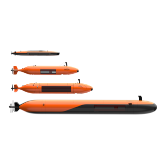
Hugin AUV
Our HUGIN Autonomous Underwater Vehicles (AUV) offer the ultimate in autonomous remote subsea survey capability. Hydrodynamic shape, accurate instruments and excellent battery capacity makes these AUV's ideal choices. Hugin is available in several configurations and depth ratings.
Read more

Uncrewed Surface Vessels (USV)
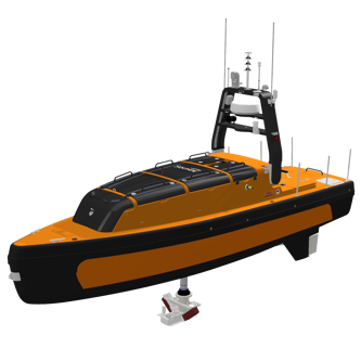
Sounder USV
Supporting sustainable operations by offering a cost-effective, efficient, and environmentally friendly solution for underwater data collection and mapping. Its advanced capabilities allow it to deliver data comparable to larger research and fishing vessels at a fraction of the cost, enabling users to cover larger areas more economically.
Read more
Seafloor mapping
Our extensive range of highly versatile seafloor mapping products have advanced functionality for efficient exploration, mapping, visualisation and analysis of the sea bottom to unlock the secrets of the deep.

EM®
Read more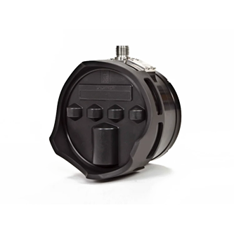
Sonars
The innovative design of the M3 Sonar® uses two sets of complementary transducers which allow it to generate both imaging and bathymetric data with the same head.
Read more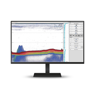
EK single beam mapping echo sounders
The EA range of single beam echo sounders is designed for various hydrographic applications, offering high performance and reliability.
Read more
TOPAS
Our TOPAS range of Sub-bottom parametric profilers allows for high performance profiling with small transducers within full ocean depth
Read more


Offshore wind-turbine scour detection
High scouring at the base of monopiles can be a problem during day to day operations of offshore wind farms. Although deep water floating wind turbines are being developed, most offshore wind farms still utilise traditional fixed-bottom foundation technologies.
The effect of scour or erosion of sediment in the vicinity of a structure can potentially be detrimental to the stability of the structure and its fatigue life.
Dual Axis Scanning Sonar
The continuous 3D-surveying capability of the DAS provides crucial information on the dynamics of sediment scour and aggregation, and its rugged design is ideal for deployment on structures located in high-current or harsh offshore environments.
Read more

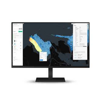
Geomatics
Geomatics ensures seamless collection, secure storage, and real-time visualization of data from all oceanographic sensors.
Read more

Marine mammal monitoring
By using passive acoustics monitoring (PAM), we can listen to life in the ocean and adapt the development of renewable energy in harmony with nature. Before, during, and after the construction of offshore wind farms, it is important to consider marine mammals:
- Before construction: Map species and establish baseline data.
- During construction: Real-time monitoring to avoid harm.
- After construction: Long-term monitoring of changes in presence and the acoustic environment.

Environmental Impact Assesment (EIA)
Mapping and quantifying marine life in the water column before proceeding with development is important for creating a baseline study. While during and after construction it is important to monitor changes in the biomass distribution.
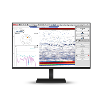
EK80 software
The Simrad EK80 is a scientific wideband echo sounder used in fisheries research, ecosystem monitoring, and increasingly in environmental assessments for offshore infrastructure.
Read more

Metorical and oceanographic studies
During the planning and design phase of a floating offshore wind project, it is essential to gather detailed information on wave and current conditions. This data is critical not only for conducting robust risk assessments related to mooring design and platform stability, but also for understanding how ocean currents influence the surrounding marine ecosystem. Such insights are vital for the Environmental Impact Assessment (EIA), particularly when evaluating potential effects on sediment transport, nutrient flow, and habitat connectivity.
Learn more about our solutions?
Need help deciding on what type of equipment you need? Interested in learning more? Don't worry, get in touch and our experts will help you.
We offer comprehensive after-sales assistance
-
24/7 Technical support
Our Technical Support team is readily available to provide global 24/7 support and can respond to resolve any issues at any time, wherever you are located in the world.
-
Training
We can provide detailed training on the use of our products to ensure your crew is equipped with the necessary operational competence to minimise technical risk and maximise return on your asset investment.