No longer sold
We still provide all relevant information about the product below

Seapath 380
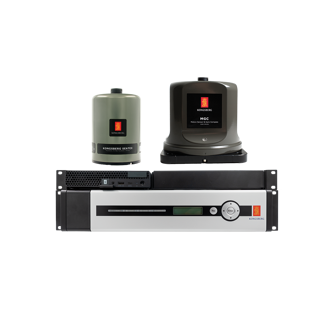
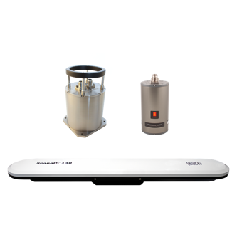
Position, attitude, time and heading sensor
The Seapath 380 series uses a state-of-the-art dual frequency GNSS receiver, inertial technology and processing algorithms to provide surveyors with the best possible accuracy in position, attitude and timing. All available GPS, GLONASS, Galileo, Beidou and QZSS satellites are used in the position solution.
Advanced Navigation Integration
Functional Design and System Configuration
Product Range and Applications
Key features
- 0.007° to 0.02° roll and pitch accuracy depending on model
- 2 cm heave accuracy by use of the PFreeHeave® algorithms
- Meets IHO special order requirements
- Robust against GNSS dropouts due to the inertial sensor part of the product
- 555-channel dual frequency GPS/GLONASS/Galileo/Beidou receiver
- All available GPS/GLONASS/Galileo/Beidou/QZSS satellites are used in the positioning solution
- Includes ionospheric compensation methods to reduce Sunspot 24 cycle effects
- Fugro XP2/G2/G4/G4+ corrections and RTK supported
- RTK corrections format RTCM and CMR supported
- Includes SBAS corrections (WAAS, EGNOS, MSAS, GAGAN)
- All data have the same time stamp and to an accuracy of 0.001 s to the actual measurement time
- Logging of raw satellite and IMU data possible
Product range
Get in touch!
In addition to our many offices around the world, our global dealership network enables distribution to more than 100 countries to meet customer needs at any location. Find your local dealership or Kongsberg Discovery office here.
Related products
We offer comprehensive after-sales assistance
-
24/7 Technical support
Our Technical Support team is readily available to provide global 24/7 support and can respond to resolve any issues at any time, wherever you are located in the world.
-
Training
We can provide detailed training on the use of our products to ensure your crew is equipped with the necessary operational competence to minimise technical risk and maximise return on your asset investment.


