Enhanced navigation and positioning
Kongsberg Seatex, the position reference division of Kongsberg Maritime, hosted a MARUSE demonstration at its premises in Trondheim, Norway on May 9th 2007. The company invited MARUSE project partners, customers and Norwegian press, in order to demonstrate the possibilities for greatly enhanced navigation and positioning using already available signals and the new Galileo satellites.
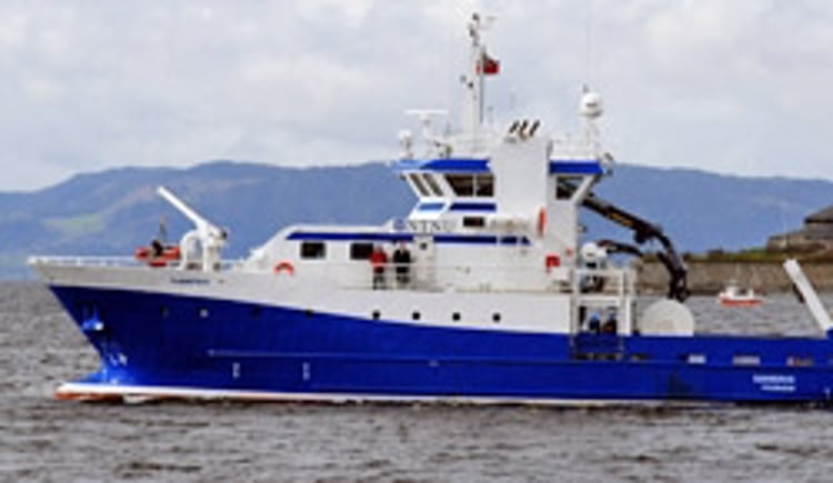
The first MARUSE demonstration in 2007
The MARUSE project was created to address topics such as security and safety, integrity, continuity, availability and accuracy through the use of the forthcoming Galileo satellite constellation. The project, which consists of leading satellite navigation companies from all over Europe is within the EU 6th Framework Programme for Research and Technology Development and is part funded by the GNSS Supervisory Authority (GSA). The Kongsberg Seatex demonstration was the first of four public MARUSE demonstrations in 2007, all of which are aimed at demonstrating future Galileo performance for the maritime community.
As the project leader/coordinator of MARUSE, Kongsberg Seatex demonstrated the vital role in the future requirements for maritime navigation that MARUSE will play. The day started with presentations by Kongsberg Seatex and MARUSE project partners, describing the scope of possibilities that Galileo and the Global Navigation Satellite System (including GPS, Glonass and SBAS) represents.
Improvements in relative positioning
The demonstration itself took place on a research vessel owned by the Norwegian University of Science and Technology, and concentrated on the improvements in relative positioning that have been achieved through MARUSE research. In order to demonstrate this, the positioning system onboard - which was based upon a newly developed Seatex Maritime User Terminal interfaced to other sensors - tracked a transponder on the quayside in Trondheim whilst sailing a short route around the Trondheims fjord.
Demonstrating the accuracy and integrity
The equipment performed extremely well, demonstrating the accuracy and integrity that had been explained throughout the day. The demo system has been developed based on the single Galileo test satellite in orbit - GIOVE A -and a combination of EGNOS, GPS and Glonass signals. Existing satellite constellations and thorough simulations have proved that significant enhancements in position accuracy and signal availability can be expected with Galileo.
Will easily adapt to Galileo
"The demonstration provided partners and customers with an insight into a forthcoming technology platform, that will easily adapt to Galileo when the full signals become available," comments Arne Rinnan, technical director at Kongsberg Seatex. "The system combines all available signals to ensure the best operation, as proven during today's demonstration. When we add Galileo signals to the mix, quality of service will immediately be raised including accuracy and availability of navigation and positioning signals."