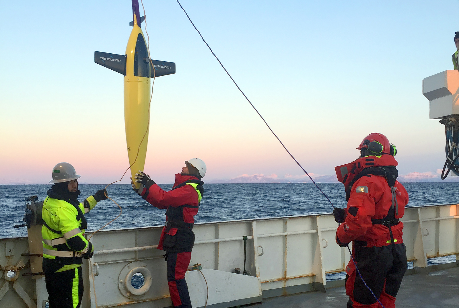
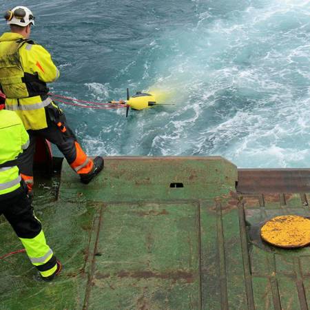
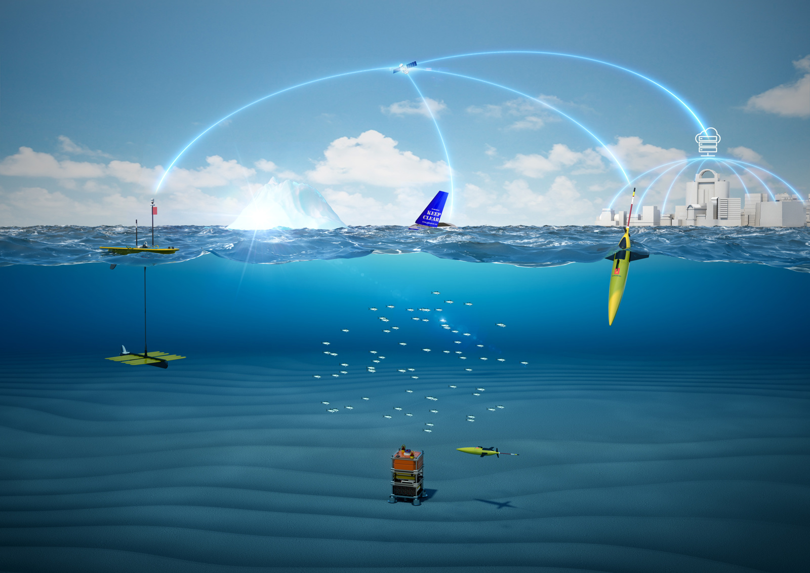
Kongsberg Maritime’s Seaglider is being sent out on a six-month autonomous mission in the sea between Bodø, the edge of the Norwegian continental shelf, and Lofoten.
-
Ove Ronny HaraldsenGroup Communication Manager
This project will give researchers access to a broader range of environmental data in terms of time and location than can be collected using traditional methods. So says Salve Dahle, director of the research company, Akvaplan-niva, and project leader.
“THERE IS A LOT THAT WE DON’T YET UNDERSTAND”
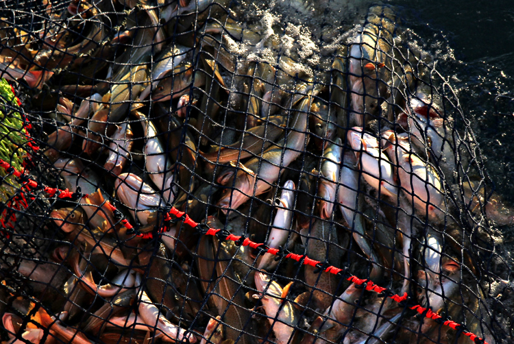
“Skrei cod migrate to these areas to spawn because of the feeding opportunities for the fry. In their first phase, the fry feed on Calanus finmarchicus, which is a type of zooplankton found in enormous quantities in this specific area.”
Researchers from Havforskningsinstituttet (the Institute of Marine Research) and a number of other institutions have been working in these marine areas for decades, and there is already an understanding of much of the interplay between Calanus finmarchicus, skrei cod and other organisms.
“But there are still big variations between years which are only partially understood. By collecting data over time and over a large area from March to September, we will be able to reach a greater understanding of how these mechanisms function and answer some of these questions”, says Salve Dahle.
AUTONOMOUSLY COLLECTING DATA
The three unmanned vessels are: one diving Seaglider produced by Kongsberg Maritime, one Sailbuoy produced by Offshore Sensing and one Wave Glider operated by Maritime Robotics.
Peer Fietzek, Manager of Science & Research at Kongsberg Maritime Contros.
Peer Fietzek, Manager of Science & Research at Kongsberg Maritime Contros, explains what kind of data these sensors are able to capture:
“The echo sounders that are used can detect organisms down to the millimetre level and see fish eggs, fish larvae and plankton in the water column. This data will significantly increase our ability to estimate the wealth, grouping and diversity of marine life. The hydrophone captures sounds that reveal the types of vocal sea mammals or sound-producing fish that are out there. With two to three Seagliders in the water, the ability to localise where these creatures are and where they are moving will be greatly improved.
TRAVELLING SILENTLY THROUGH THE WATER
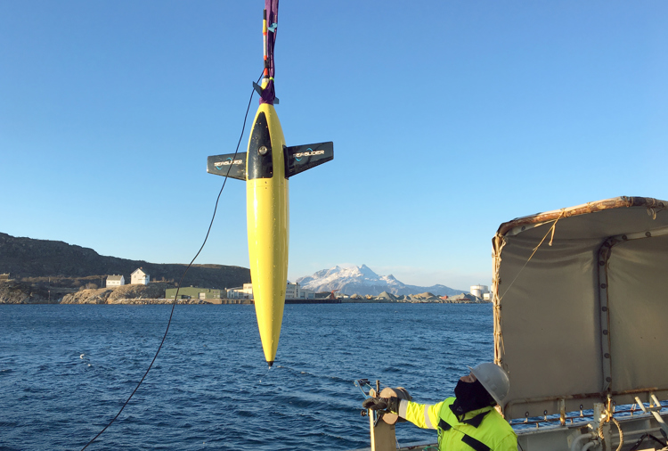
The Seaglider from Kongsberg Maritime can operate for ten months at a time without significant assistance from land. The vessel rises and sinks through the water by moving oil between a reservoir located within the pressure hull and a bladder located on the exterior.
When the oil is pumped into the bladder, the bladder’s volume increases. This makes the glider more buoyant and causes it to rise in the water. When it needs to go deeper, the procedure is reversed.
Wings on the fuselage push the vessel forward when it rises or sinks. Adjusting the vessel’s centre of gravity gives additional control and for examples enables to produce a turn. For the most part, forward movement is completely silent, which is an advantage that allows for non-invasive research.
In addition to the hydrophone, Seaglider is equipped with sensors that measure temperature, oxygen level, pressure and other important oceanographic parameters.
“Seaglider measures important parameters throughout the entire water column to depths of 1,000 metres. This is data of high quality and density and important input for researchers’ calculations”, says Peer Fietzek.
“PROVIDING BETTER OCEAN FORECASTS”
Some of the data collected from the project’s three drones is sent to land via satellite, where it can be visualised and analysed in nearly real time. Some of the material is stored on-board and retrieved at certain intervals.
Data that is transmitted via satellite is continuously shared with the Norwegian Meteorological Institute, one of the partners in the project, which has already made use of the data.
“The measurements taken by the gliders are used to improve the physical models of the area. Provisional results already indicate that the extra data coming from the gliders could improve forecasting capabilities”, says Peer Fietzek of Kongsberg Maritime.
USING KOGNIFAI
As it arrives, data is received, stored and distributed using Kognifai, a digital platform developed by Kongsberg Digital.
“Kognifai is perfect for this project and functions as a meeting place for industrial and scientific data and applications. Kognifai collects all the different data from the gliders in one database. The different partners can carry out their research through visualisation and processing. All these interfaces in one digital environment facilitate easy access and effective distribution of data to the users”, says Peer Fietzek.

The GLIDER project is a shining example of what KONGSBERG can achieve when different areas within the company work together. Kongsberg Underwater Technology in Lynnwood in the USA supplies the Seaglider, which, among other things, is equipped with an oxygen sensor produced by KM Contros in Kiel in Germany. Simrad in Horten supplies echo sounders, and Kongsberg Digital in Asker supplies the Kognifai platform for data management.
“Here we see in practice what we can achieve when we combine the knowledge that we know is present at KONGSBERG. There is huge potential in challenging our technical expertise with these types of applications where different technologies are brought together to form a greater whole. This also demonstrates the value of collaboration between industry and research,” says Peer Fietzek of Kongsberg Maritime.
SET FOR COMMERCIALISATION
The use of drones in conjunction with Kognifai contributes to making data collection more flexible and cost-effective. Through the methodology that is currently being developed, we will be able to collect broader environmental data in terms of time and location than can be collected using traditional methods. Kognifai will ensure that the data is distributed and tailored to the needs of different end users.
The project will, in collaboration with users, develop a system for presenting and managing the data material that is collected, explains Salve Dahle of Akvaplan-niva.
Salve Dahle, director of the research company, Akvaplan-niva.


